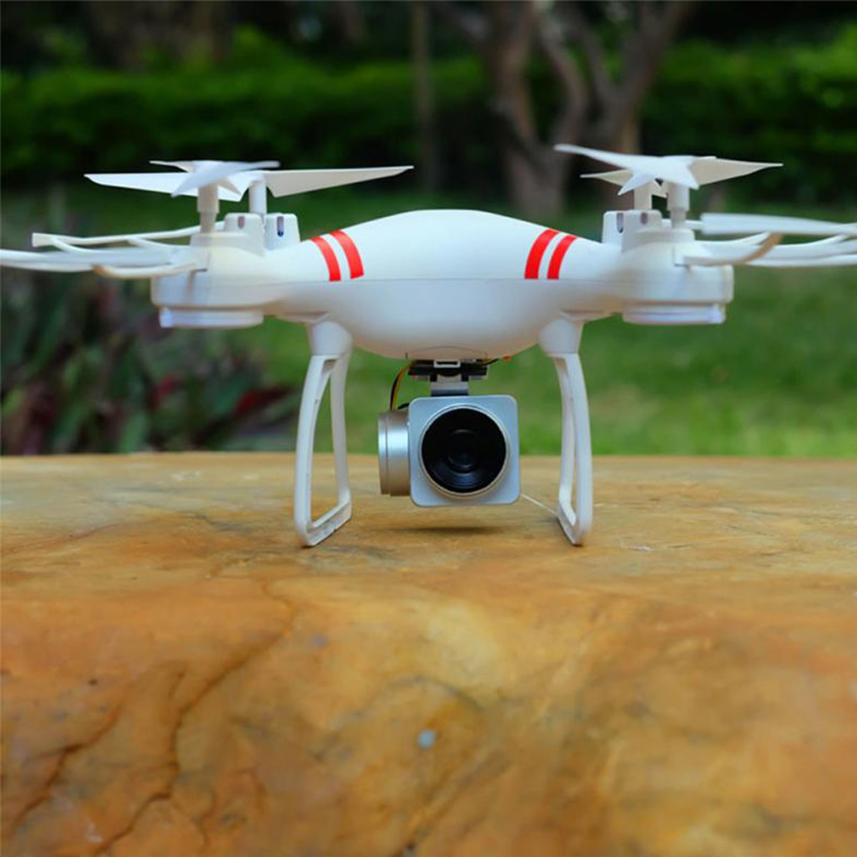
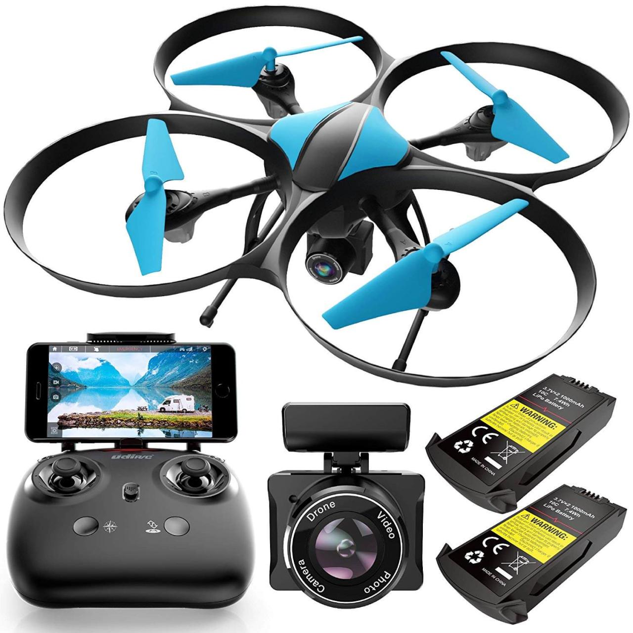
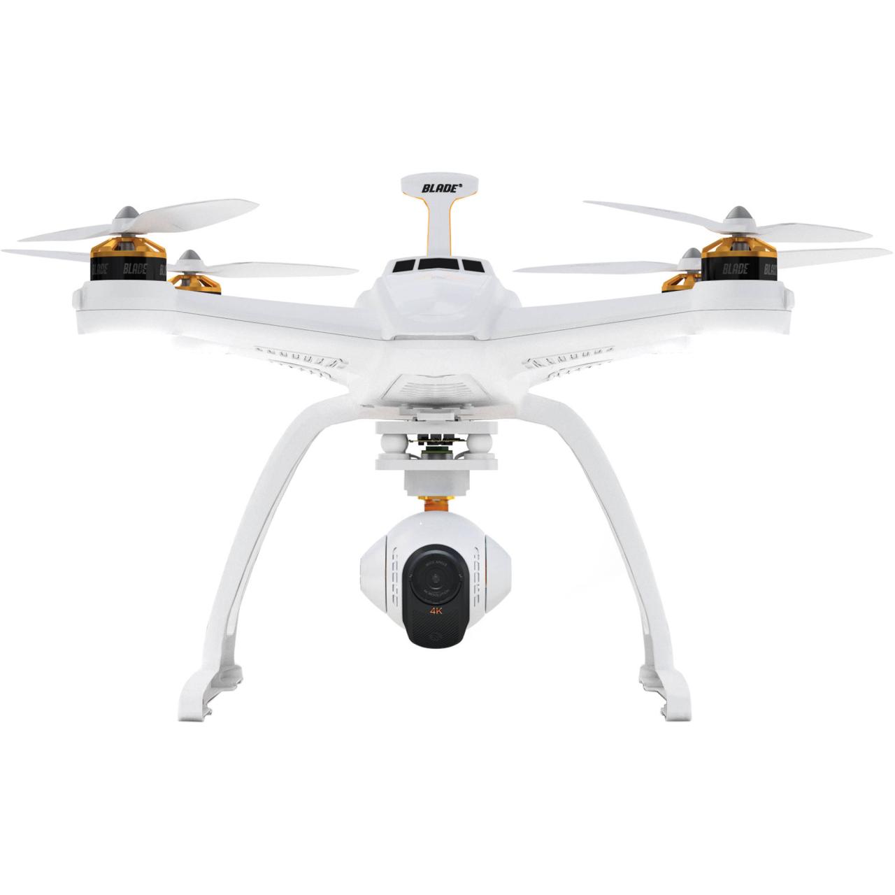
Drone with camera technology has revolutionized various sectors, from filmmaking and real estate to agriculture and search and rescue. This comprehensive guide delves into the diverse types of drones available, exploring their capabilities, applications, and the crucial aspects of flight operation and post-processing. We’ll examine different camera technologies, flight modes, and legal considerations, equipping you with a thorough understanding of this rapidly evolving field.
From understanding the nuances of camera sensors and flight planning to mastering post-processing techniques and adhering to safety regulations, this guide aims to provide a practical and informative resource for both beginners and experienced users. We will cover everything from selecting the right drone for your needs to ethically and safely utilizing this powerful technology.
Types of Drones with Cameras

Drones with cameras offer a versatile range of capabilities, catering to diverse needs and skill levels. Understanding the different types available is crucial for selecting the right tool for your specific application. This section categorizes drones based on size, features, and intended use, highlighting their strengths and weaknesses.
Drone Categories by Size, Features, and Use
| Size | Features | Intended Use | Example Models (Illustrative – Specifications Vary by Manufacturer) |
|---|---|---|---|
| Nano | Basic camera, limited flight time, often lacks GPS or obstacle avoidance | Indoor photography, recreational use | Several small, toy-like drones fit this category. Expect short flight times (under 10 minutes) and very basic camera capabilities (low resolution, fixed lens). |
| Micro | Improved camera quality, longer flight time than nano, may include GPS | Outdoor photography, videography, short-range inspections | Many micro drones offer improved camera resolution and flight times (10-20 minutes). Some might include basic GPS for stability. |
| Mini | GPS, obstacle avoidance, longer flight time, higher-resolution camera | Aerial photography, videography, real estate photography | Mini drones are popular for their balance of portability and features. Expect flight times around 20-30 minutes and improved camera specs (e.g., 4K video). |
| Standard | Advanced features (GPS, obstacle avoidance, follow-me mode, gimbal), high-quality camera, long flight time | Professional photography, videography, surveying, mapping | Standard drones are workhorses, offering extended flight times (30+ minutes), high-resolution cameras, and advanced flight modes. |
| Large | Heavy lifting capacity, long flight time, high-quality cameras, advanced features | Industrial applications (inspection, surveying, delivery), cinematography | These drones are designed for professional use, often equipped with interchangeable lenses and specialized payloads. Flight times can exceed 40 minutes. |
Drone Specifications Comparison

The following table provides a comparison of key specifications for three illustrative models within each size category. Note that actual specifications vary significantly by manufacturer and model.
| Size | Model A | Model B | Model C |
|---|---|---|---|
| Nano | Flight Time: 5 min; Camera Resolution: 2MP; Sensor Size: 1/5″; Range: 50m | Flight Time: 7 min; Camera Resolution: 5MP; Sensor Size: 1/4″; Range: 80m | Flight Time: 8 min; Camera Resolution: 8MP; Sensor Size: 1/3″; Range: 100m |
| Micro | Flight Time: 12 min; Camera Resolution: 12MP; Sensor Size: 1/2.3″; Range: 200m | Flight Time: 15 min; Camera Resolution: 20MP; Sensor Size: 1/2″; Range: 300m | Flight Time: 18 min; Camera Resolution: 4K; Sensor Size: 1/1.7″; Range: 400m |
| Mini | Flight Time: 25 min; Camera Resolution: 4K; Sensor Size: 1/2.3″; Range: 500m | Flight Time: 30 min; Camera Resolution: 48MP; Sensor Size: 1/1.7″; Range: 700m | Flight Time: 35 min; Camera Resolution: 4K; Sensor Size: 1″; Range: 1000m |
| Standard | Flight Time: 40 min; Camera Resolution: 4K; Sensor Size: 1″; Range: 2km | Flight Time: 45 min; Camera Resolution: 6K; Sensor Size: 1″; Range: 3km | Flight Time: 50 min; Camera Resolution: 8K; Sensor Size: Super 35; Range: 4km |
| Large | Flight Time: 60 min; Camera Resolution: 8K; Sensor Size: Super 35; Range: 5km | Flight Time: 70 min; Camera Resolution: 12MP; Sensor Size: Medium Format; Range: 7km | Flight Time: 80 min; Camera Resolution: 4K; Sensor Size: Large Format; Range: 10km |
Camera Technology in Drones
The image quality and capabilities of a drone are heavily influenced by its camera technology. Understanding the different sensors and lens types is essential for making informed purchasing decisions.
Camera Sensor Types and Their Characteristics, Drone with camera

Two primary types of image sensors are commonly used in drone cameras: CMOS (Complementary Metal-Oxide-Semiconductor) and CCD (Charge-Coupled Device). CMOS sensors are now more prevalent due to their lower power consumption, faster readout speeds, and better performance in low-light conditions. CCD sensors, while offering potentially higher image quality, are less energy-efficient.
Different lens types also play a crucial role. Wide-angle lenses are common for capturing expansive landscapes, while telephoto lenses allow for closer views of distant subjects. Fixed-focus lenses are simpler and lighter, while adjustable-focus lenses offer greater versatility.
Impact of Aperture, Shutter Speed, and ISO
Aperture, shutter speed, and ISO are fundamental photographic concepts that significantly impact image quality in drone photography and videography. Aperture controls the amount of light entering the camera, affecting depth of field. Shutter speed determines the duration of light exposure, influencing motion blur. ISO represents the sensor’s sensitivity to light, affecting noise levels. Mastering these settings allows for greater creative control and optimized image quality in various lighting conditions.
Applications of Drones with Cameras
Drones with cameras have revolutionized numerous industries, offering efficient and innovative solutions for various tasks. Their applications span diverse sectors, from agriculture to search and rescue.
Drone Applications Across Industries
- Agriculture: Crop monitoring, precision spraying, livestock management. Drones provide a bird’s-eye view, allowing for efficient assessment of crop health and targeted interventions.
- Construction: Site surveying, progress monitoring, safety inspections. Drones offer a safe and efficient way to monitor construction progress, identify potential safety hazards, and create detailed site maps.
- Real Estate: Property photography, virtual tours, marketing materials. Aerial photography provides stunning visuals for real estate listings, showcasing properties from unique perspectives.
- Filmmaking: Aerial cinematography, unique perspectives, dynamic shots. Drones enable filmmakers to capture breathtaking aerial shots, adding a new dimension to their storytelling.
- Search and Rescue: Locating missing persons, assessing disaster areas, providing situational awareness. Drones can quickly cover large areas, assisting search and rescue teams in locating individuals and assessing the extent of damage after natural disasters.
Thermal Imaging for Building Inspection
A scenario involving a building inspection using a drone with a thermal camera might involve detecting potential problems such as insulation deficiencies, water leaks, or electrical faults. The thermal camera captures heat signatures, revealing temperature variations that indicate these issues. For instance, a cold spot on an exterior wall might indicate poor insulation, while a hot spot could point to a faulty electrical connection.
The use of thermal imaging significantly reduces the time and cost associated with traditional inspection methods, leading to quicker identification and resolution of problems.
Drone Flight and Image Capture Techniques: Drone With Camera
Achieving high-quality aerial imagery requires understanding different flight modes and employing effective image capture techniques. Proper planning and execution are essential for successful drone operations.
Drones equipped with cameras offer incredible aerial perspectives, enabling stunning photography and videography. However, responsible operation is crucial, as highlighted by recent incidents like the one detailed in this report: nj drone shot down. Understanding regulations and safety protocols is paramount for ensuring both the safe and legal use of camera drones, ultimately protecting both the operator and the public.
Flight Modes and Their Impact
Drones offer various flight modes, including manual, autonomous, and waypoint modes. Manual mode provides direct control over the drone’s movements, while autonomous modes enable pre-programmed flight paths. Waypoint mode allows for setting specific points for the drone to navigate, enabling precise data collection. The choice of flight mode significantly impacts image quality and data collection efficiency, with autonomous modes generally increasing efficiency for repetitive tasks.
Planning a Drone Flight for Aerial Photography
- Pre-flight checks: Battery level, GPS signal, camera settings, weather conditions.
- Flight path planning: Determining the optimal flight path to capture desired images and avoid obstacles.
- Image acquisition: Setting camera parameters (aperture, shutter speed, ISO) and capturing images at appropriate intervals.
Achieving Specific Camera Angles
Nadir views capture images directly below the drone, providing a vertically downward perspective. Oblique views capture images at an angle, offering a more dynamic and three-dimensional perspective. Zenith views capture images from directly above, providing a top-down perspective. Understanding and utilizing these different camera angles enhances the visual appeal and information content of aerial imagery.
Post-Processing and Image Enhancement
Raw drone imagery often requires post-processing to enhance its visual appeal and extract valuable information. This section details common techniques and software used for image enhancement and data analysis.
Post-Processing Techniques
Common post-processing techniques include color correction to adjust brightness, contrast, and color balance; stitching to combine multiple images into a larger panorama; and stabilization to reduce the effects of camera shake and vibrations. These techniques significantly improve the overall quality and usability of drone imagery.
Photogrammetry and 3D Modeling
Software for photogrammetry allows for creating 3D models and maps from overlapping drone images. This technique is invaluable for applications such as construction progress monitoring, site surveying, and archaeological studies. Specialized software processes the images to generate accurate 3D representations of the scene.
Enhancing Drone Images with Image Editing Software
- Import the image: Open the drone image in your chosen image editing software (e.g., Adobe Photoshop, GIMP).
- Adjust brightness and contrast: Fine-tune these settings to optimize the overall image appearance.
- Correct color balance: Ensure accurate and consistent colors throughout the image.
- Sharpen the image: Enhance details and clarity.
- Reduce noise: Minimize graininess and improve image quality.
- Export the enhanced image: Save the image in a suitable format (e.g., JPEG, TIFF).
Legal and Safety Considerations
Operating drones with cameras requires adherence to legal regulations and safety protocols. Responsible drone operation is crucial for ensuring public safety and preventing accidents.
Drone Regulations and Guidelines
Regulations governing drone operation vary by region and country. It’s essential to familiarize yourself with local laws and obtain any necessary permits or licenses before flying a drone. These regulations often cover aspects such as registration, airspace restrictions, and operational limitations.
Safety Protocols for Drone Operation
- Pre-flight checks: Thoroughly inspect the drone and its components before each flight.
- Visual line of sight: Maintain visual contact with the drone at all times.
- Weather awareness: Avoid flying in adverse weather conditions (strong winds, rain, snow).
- Airspace awareness: Be aware of airspace restrictions and avoid flying near airports or other sensitive areas.
- Battery management: Use properly charged batteries and monitor battery levels during flight.
Responsible Drone Use and Ethical Implications
Responsible drone operation includes respecting privacy, avoiding unauthorized surveillance, and adhering to ethical guidelines. The use of drones should be conducted in a manner that is both safe and respects the rights and privacy of others. Ethical considerations should guide all aspects of drone operation, ensuring responsible and beneficial use of this technology.
Drones equipped with cameras offer a unique perspective, allowing for stunning aerial photography and videography. For those interested in high-quality imagery of specific locations, exploring options like the advanced camera systems available at the port dover camera site might be beneficial. This could significantly enhance the capabilities of your drone, providing improved image clarity and detail for your projects.
The integration of cameras into drone technology has unlocked unprecedented possibilities across numerous industries. This guide has explored the multifaceted nature of drone-based aerial imagery, encompassing technological advancements, practical applications, and essential safety protocols. By understanding the diverse capabilities of drones with cameras and adhering to responsible operational practices, we can harness their potential while mitigating risks and ensuring ethical deployment.
The future of drone technology promises even greater innovation, further expanding its impact on various fields.
Clarifying Questions
What is the flight time of most consumer drones?
Flight times vary greatly depending on the drone model and battery size, ranging from 15-30 minutes for smaller drones to over 40 minutes for larger models. Always check the manufacturer’s specifications.
How do I legally fly a drone?
Drone regulations vary by location. You’ll need to register your drone and potentially obtain a license depending on your country and intended use. Always check local laws and regulations before flying.
What type of storage card is recommended for drone footage?
High-speed microSD cards with a UHS-I or UHS-II rating are recommended for recording high-resolution video and photos smoothly. Consider the capacity based on your recording needs.
Can I use my drone in bad weather?
No, flying drones in rain, strong winds, or low visibility is extremely dangerous and can lead to accidents or damage to the drone. Always check the weather forecast before flying.
